
Walk a Chapel Hill Street Record by Record
Ownership and occupancy are different facts. For a Chapel Hill address, begin with Orange County’s property tools because they connect a street address to a parcel identifier. The next records should be read as dated evidence, not assembled into a broad list of households. A deed identifies an indexed property interest, while a voter result identifies registration context. A historical directory can place a person at an address in its publication year, but it cannot establish a present-day household. The most reliable result keeps those labels separate.
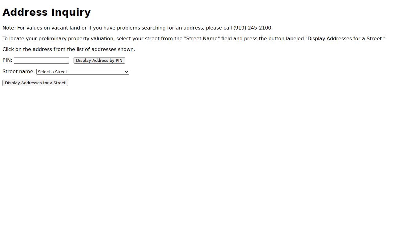
- Use Orange address inquiry to choose the street and display its addresses. Open an address to obtain its PIN rather than treating the street list as a list of people.
- Enter the PIN or address in Orange PIN Inquiry or the county GIS. Record the current owner string, legal description, township, book/page reference, and the date shown.
- Use the owner name or PIN in the Orange County deed index. Select the party role and a date range before drawing any conclusion from a name hit.
- If a known name needs a separate registration check, use North Carolina Voter Search with first and last name, a status choice, and optional county or birth-year filters. The live form is not an address-search form.
- For an earlier household clue, compare a dated entry in Chapel Hill Public Library genealogy resources with the relevant directory year and a second source.
That address-to-PIN-to-owner-to-deed-to-voter-to-directory route is deliberately narrow. It avoids calling a parcel owner an occupant, and it gives a way to document uncertainty when one source does not match another.
Use Chapel Hill PIN and GIS Fields
Orange PIN Inquiry is especially useful once an address is known. Its primary tracking method is the PIN, and it offers current and prior-owner paths as well as PIN History. The history view can expose parent or child parcel links and book/page document icons. Those links can explain a split or recombined parcel, but they do not by themselves prove that a newer parcel has the same legal history as its parent. Preserve leading zeroes when a PIN is supplied.
| Orange tool | Fields or modes | Useful result |
|---|---|---|
| PIN Inquiry | PIN, active/inactive status, township, current owner, legal description, recorded-date range, book/page, sub code | Parcel identity and a documented owner or history lead |
| Orange GIS viewer | Owner name, parcel ID, NCPIN, physical address, account number; street, subdivision, condominium, neighborhood, and location tools | Map context, parcel detail, tax card, adjoiners, and CSV-capable selected results |
| ARIES | Address or map point with parcel, owner, subdivision, township, appraisal/deed, school, fire, Census block, library, recycling, and voting context | Address context that should be labeled by its source date |
For a visual reference, the Orange PIN Inquiry screen shows the public application used to move from a property clue to the relevant inquiry tabs.
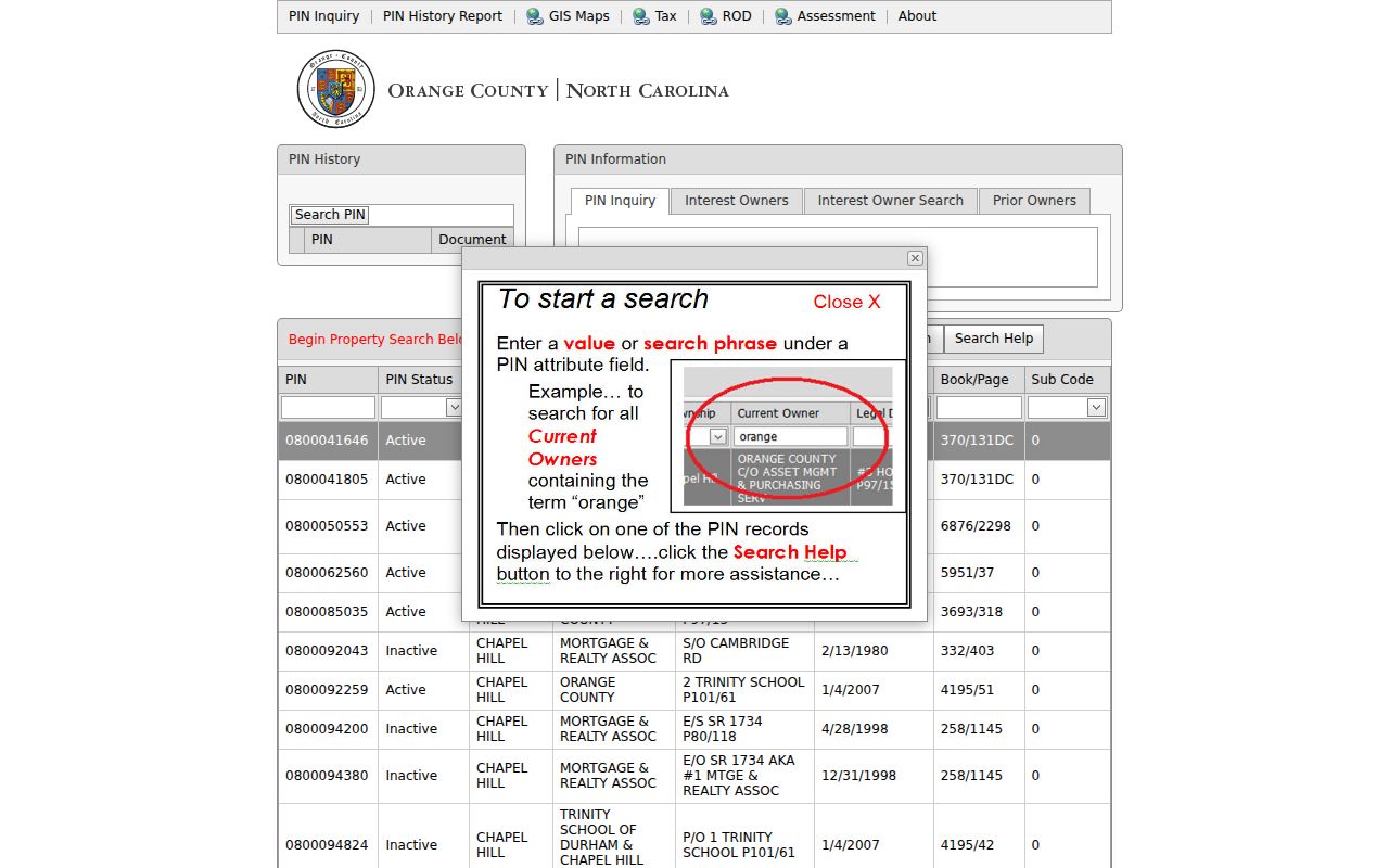
Use the result fields as a citation trail. A current-owner label, legal description, and recorded date say more about the record than a map label alone.
Note: A mapped owner field is not evidence that the owner occupies every physical address shown for a parcel.
Map Chapel Hill Streets to Parcels
Orange GIS help describes how a physical-address search first works through the two-part address data set and then finds parcels that contain the address. Search can be narrowed to a field, and the viewer also supports select-by-location, a distance buffer, and an Adjoiners selection for parcels touching the selected parcel. The practical use is geographic: confirm the parcel and nearby boundaries before comparing any associated record.
The GIS search and export reference illustrates the address, parcel, map, and report controls available in the viewer.
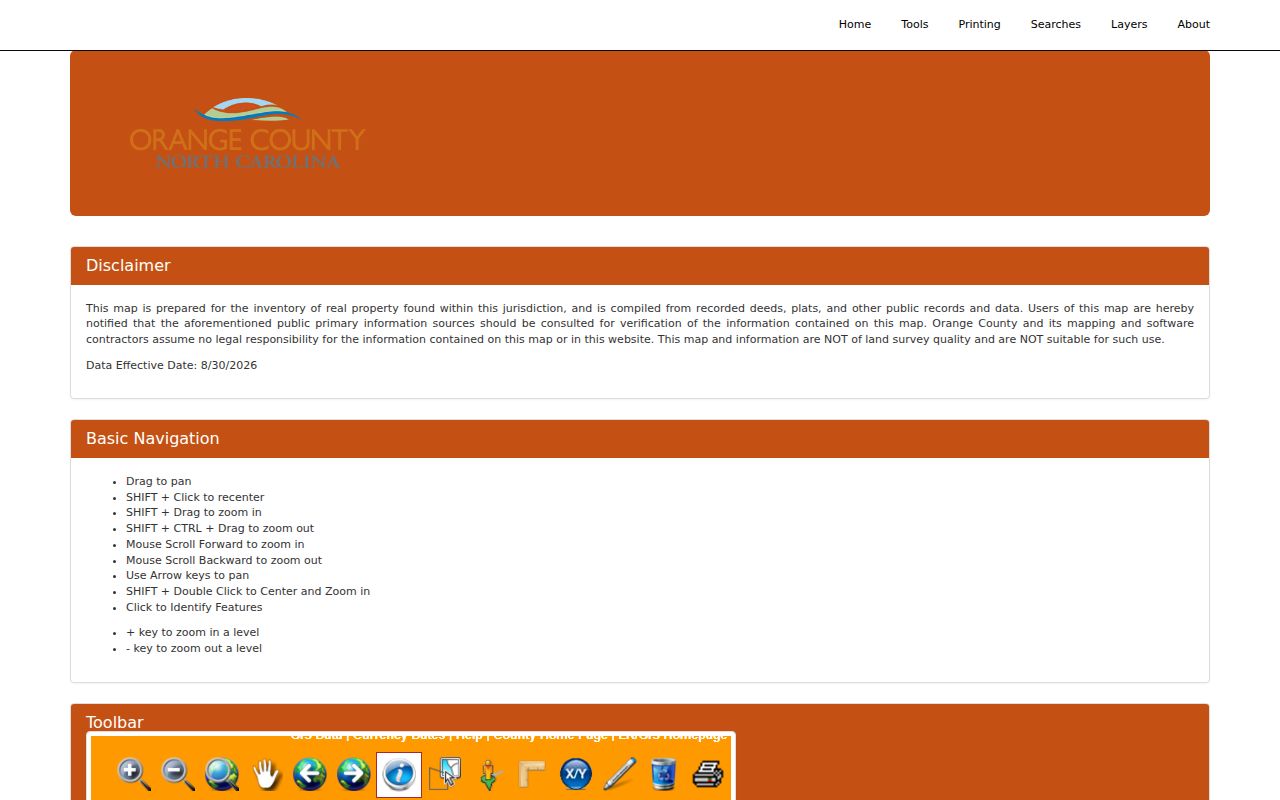
GIS layers may include ownership context, historic orthophotos, and overlays. Check zoning, flood, or land-use claims with the responsible Town or county source instead of reading a color on the map as a legal finding.
Search Chapel Hill Deeds by Role and Date
The Orange County Register of Deeds index is free to search and displays coverage from September 1, 1932 through July 31, 2026. It accepts last or firm name, first name, grantor, grantee, or either party role, dates, party type, document and book types, tax dates, description or PIN, document number, book, and page. Match choices include Exact Match, Begins With, Match Contains, Advanced Similar Name, and Soundex Similar Name. Log the role, filters, and match mode because each choice can return a different set.
The deed-index search form shows the role and record controls used for a focused street-directory property search.
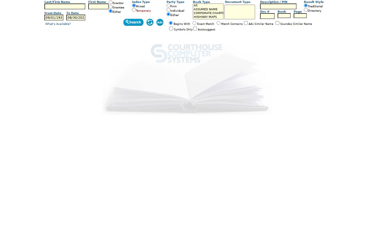
A result row can identify the parties, roles, recording date, document type, book, page, and document number if shown. It is an index lead, not a certified copy. Printing results requires login, and the reviewed sources did not establish an image price or an online certified-copy procedure.
Chapel Hill Street Records by Address
Different record systems share an address without answering the same question. Orange County Tax Administration, GIS, the Register of Deeds index, elections resources, and Town records each have their own fields, dates, and access rules. A PIN is the best bridge between property tools and instruments. A street name helps normalize location, but a Chapel Hill mailing ZIP, a public map label, or a property owner name is not a complete resident record.
| Address-related source | Custodian or route | What it can show | Access limit |
|---|---|---|---|
| Property and PIN record | Orange County Tax Administration | Parcel identifiers, ownership fields, legal and assessment context | Owner is not automatically an occupant |
| Parcel and address map | Orange GIS | Physical address, parcel, adjoining parcels, map and selected report tools | Map and address data establish location, not household membership |
| Recorded instrument index | Orange County Register of Deeds | Dated parties, roles, document type, book/page, PIN or description | Index result is not a certified copy |
| Registration record | North Carolina voter data | Public voter-file fields and dated registration context | Live lookup is name-based and protected addresses may be withheld |
| Permit or code material | Town Clerk and Building Inspections | Requested permit, planning, or certificate-of-occupancy material | No public permit-search field set was documented on the reviewed page |
North Carolina’s Public Records Law supports inspection of public records as provided by law, but it does not require an agency to build a new complex query. For a missing local record, ask the right custodian for an address or PIN, record type, date range, preferred format, and whether inspection or a copy is requested. Orange County routes requests through NextRequest, which launched in March 2026 and provides status tracking.
Keep Chapel Hill Voter Evidence Narrow
North Carolina Voter Search requires first and last name and a choice of Registered or Removed/Denied status; middle initial, year of birth, and county are optional selectors. That makes it useful after an owner or historical directory supplies a name, not as a street-browse tool. Public results can include registration details, jurisdictions, polling place, sample ballot when available, absentee information, and voter history. A result should be treated as current only on its search date.
The State publishes current and historical voter-registration files, including county files, through its voter-registration data page. Current files update weekly on Sunday evenings. Full birth date, Social Security number, driver-license number, and photo-ID data are excluded from public current files. A registration address also does not prove property ownership, and an Address Confidentiality Program participant may have a protected address.
Note: Voter history shows participation information, not a ballot choice or a reliable measure of political belief.
Chapel Hill Street Permit Records
Chapel Hill Building Permits and Inspections describes permit categories and a Secure Portal account workflow, including authenticated dashboards, tasks, messages, attachments, and past or current permit and license history. The reviewed public page did not expose a public search form for address, date, status, or export. Do not infer that a portal account dashboard is a public permit index.
The Town’s permits page is the source for the account and application process shown here.
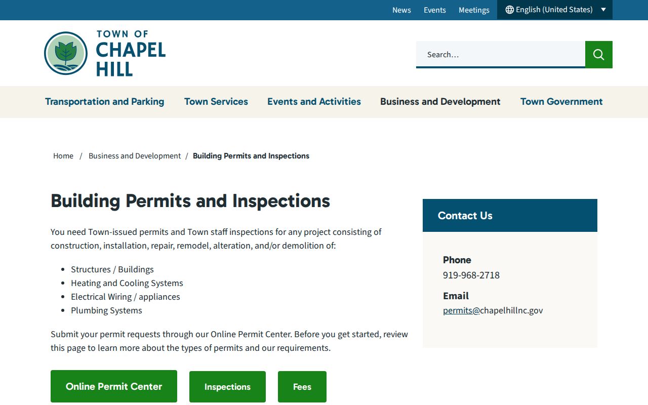
For a specific public record, the Town says permit and planning material is available online and certificate-of-occupancy records can be pursued through Building Inspections at 919-968-2718. Code Enforcement uses the same phone number and lists codeenforcement@chapelhillnc.gov. State the address or PIN, permit number if known, record type, date range, and whether issued, expired, or closed material is sought.
Chapel Hill Street Directory Dates Matter
For a past household, a directory entry is only as good as its printed year. The confirmed digital Chapel Hill runs are Hill’s directories for 1959 and 1961, with the latter including Carrboro. The research did not establish a complete yearly series, and a historic-district report says Chapel Hill had no city directories before the 1950s. The library genealogy page, the Orange County Local History Collection, and the Chapel Hill Historical Society resources are the proper alternatives when an edition is missing.
Chapel Hill developed around the University, so municipal and University records can overlap without sharing a custodian. A campus directory or yearbook may establish affiliation, not a town address. The library genealogy resources also list the Chapel Hill Weekly for 1923 through 1972, a dated local source that can support a separate address clue.
The Orange address inquiry provides the street-selection and address-to-PIN path that can help normalize an older address before searching another source.
A dated address entry is a useful historical signal, especially when a newspaper, deed, census, cemetery, or town-minute source agrees. The historical collections themselves are treated in more depth on the Chapel Hill city directory page.
Five Chapel Hill Sanborn Maps
The NCSU Sanborn map list identifies five Chapel Hill maps spanning 1911 to 1949. The exact edition years for those five maps were not parsed in the research, so they should not be stated as an exact year-by-year run. Fire-insurance maps can show building footprints, materials, uses, stories, streets, and lot relationships. They do not identify the people inside a building on the map date.
Pair a Sanborn sheet with a dated directory, tax or deed source, and a newspaper or minutes record. This is particularly helpful on Franklin Street or around older campus-adjacent structures, where street numbers, lots, and uses may have changed. Capture the sheet, edition, access date, and the uncertainty between historic street geometry and a current parcel.
Chapel Hill Street Directory Terms
Address research becomes clearer when each label stays attached to the record type that produced it. The following terms recur in Orange County’s property and historical-address sources.
- Parcel
- A tract or unit tracked by the county for property and assessment purposes, usually through a PIN or NCPIN.
- Situs address
- The physical location assigned to a property. It can differ from an owner’s mailing address and can change over time.
- Plat
- A recorded map that depicts lots, boundaries, streets, or subdivisions. A plat-book image or reference needs its own source label.
- Criss-cross directory
- An address-organized historical directory used to find a dated household clue. It is not a current-resident roster.
Limits of a Chapel Hill Street Directory
No official source reviewed supplies a complete, current citywide roster of people along Chapel Hill streets. A parcel can be vacant, have multiple physical addresses, or be owned by someone whose current address is elsewhere. Historic entries can persist after a move or death. ZIP labels spill beyond town boundaries: the local references identify 27514, 27516, and 27517 for Chapel Hill delivery, but each needs address-level confirmation through USPS and GIS.
When a record is incomplete, save its source, date, coverage, and limitation rather than filling the gap with an assumption. A missing result can reflect redaction, a protected address, a changed street number, a different jurisdiction, or an unindexed historical source.